
At the U.S. Army’s drone training facility, a team of artists examines the relations between perception, technology, and power.
Read MoreThe EU Border: Frontex to the Hellenic Coast →
The Intimate Technology of Remote Vision →
This essay is an excerpt from Incendiary Traces: Hillary Mushkin, published in conjunction with the 2017 Pomona College Museum of Art exhibition, "Project Series 51: Incendiary Traces."
Read MoreView from the Top: Plein-Air Surveillance at Point Mugu

Joseph Bolstad | Sketch of Laguna Peak Tracking Station, 2016 | Colored pencil on paper
A close-up look at Laguna Peak Tracking Station, perched on a 1,500-foot mountain peak in Point Mugu, above Naval Base Ventura County.
Read MoreReconnaissance: Inside the Panopticon
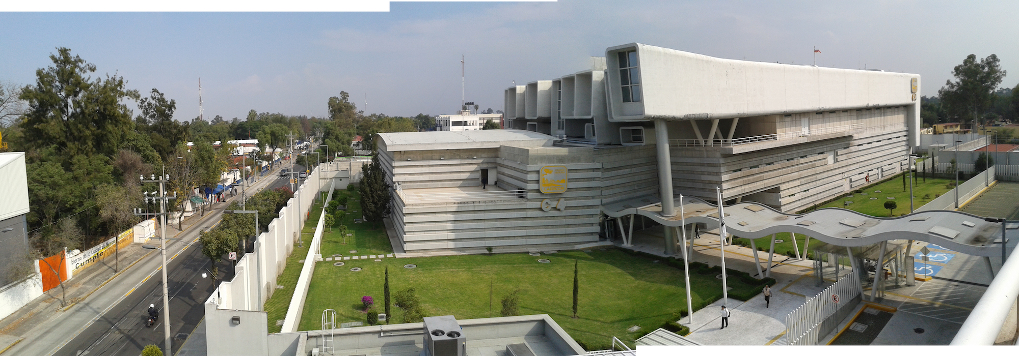
Fig. 3: Panoramic view of the C4i4 from the parking lot rooftop | photo by Paulina V. Pulido
Incendiary Traces reports on visiting the controversial and architecturally formidable C4i4, Mexico City's police surveillance hub.
Read MoreMachines for Training: Military Performance and Embodied Knowledge

An examination of how military groups employ simulation, role-playing, and performance to deliver training required to operate in the extreme conditions of combat.
Read MoreDesert Deployment: Southern California’s World War II Desert Training Center

U.S. Army Photograph, 1942. Courtesy of the General Patton Memorial Museum.
Thirty miles east of Indio, California in a largely uninhabited desert landscape, sits the largest military training ground in U.S. history, though you might not have heard of it.
Read MoreImagining Global War: Popular Cartography during World War II
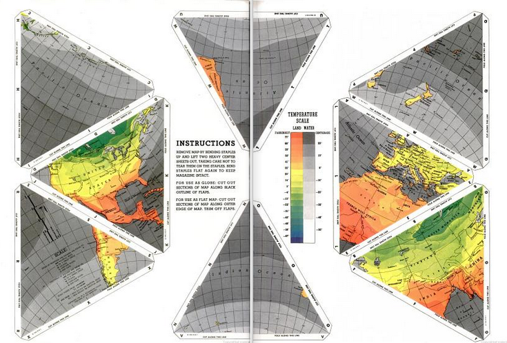
A look at American cartographic representations of WWII Europe, providing historical context for understanding our conception of global space.
Read MoreSketching Simulated Battlefields in Silicon Beach

View from a ridge in DICE-T with platoon leader’s location | Drawing by Jena Lee
Incendiary Traces pays a virtual visit to an Afghani village to make the seemingly remote conflict a bit more comprehensible to those in the U.S.
Read MoreVisualizing War: Virtual Reality, Simulations, and Physical Battlefields

Predator Mission Aircrew Training System (PMATS) pilot/payload operator workstations | Photo: General Atomics
Simulations in computer games and virtual reality are radically altering the way the military prepares soldiers for war.
Read MoreArtists, Surveillance and Patrol at the Border

A view of the Pacific from Bunker Hill at the US-Mexico Border | Watercolor by Hillary Mushkin
Incendiary Traces visits the U.S.-Mexico Border to view the binational boundary from the perspective of U.S. Border Patrol agents.
Read MoreCrossing the Line: A History of Medical Inspection at the Border
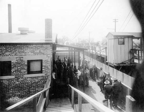
Mexicans quarantined at the Santa Fe Bridge Disinfection Plant, 1917 | USPHS, National Archives
In the early 1900s, medical inspection and photographic documentation ushered in a new set of surveillance procedures for state oversight at the U.S.-Mexico border.
Read MoreInvestigating the Representations of Battlespace

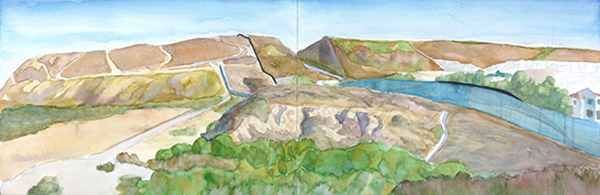
San Clemente Island Naval Weapons Testing Range | Watercolor by Hillary Mushkin | 2012
Unless you’ve been to war or are close to someone who has, you probably have a mediated experience of war. Most Americans do. This experience is complex: while reading or watching the news informs audiences about critically important and violent events, civilians can also feel like war is distant and immaterial. This makes it challenging to engage compassionately. Incendiary Traces takes on this challenge through a combination of experimental art, research and media. The project directly involves participants in visualizing war through outdoor drawing events in militarized sites around Southern California. In tandem, and in collaboration with Artbound, we publish reports on these experiences along with images and essays from diverse contributors on related topics. The goal is to lessen that gap -- to make the war we read about on the front page more tangible.
Incendiary Traces at Friendship Circle, Border Field State Park | Photo by Maria Teresa Fernandez | 2012
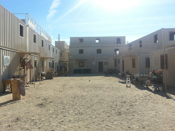
MOUT (Military Operations on Urban Terrain) at Twentynine Palms Marine Air Ground Combat Center | Photo by Nancy Buchanan | 2013
Incendiary Traces began in 2012-13 with a thematically linked series of outdoor drawing events and Artbound publications centered around four exemplary types of Southern California landscapes: urban, coastal, desert and international border. The events were held at militarized sites where participants could learn something new about picturing war from people who do this professionally. We went to Northrop Grumman Space Park Drive Aerospace HQ, took a fishing boat around San Clemente Island Naval Weapons Testing Range, visited the 29 Palms Marine Corps Air Ground Combat Center, and San Diego’s Border Field State Park. Participants spent time drawing and otherwise observing these sites where military professionals, border patrol agents and fishermen visualize international conflict. Artbound published reports on these events, and related essays on technological viewing, military visions of the Pacific islands, the Southern California desert as a stand-in for the Middle East, and lines of sight and site along the U.S. Mexico border. We are now embarking on a second series, building upon the insights gained from the first one.

Still from Virtual Reality Exposure Therapy at USC Institute for Creative Technologies | Photo by Jena Lee | 2013
While the first series surveyed various types of landscapes in our region that serve as the backdrop for picturing war—in other words, where the military does this—in the coming months we’ll focus on the methods Southern California professionals use to visualize international conflict – that is, how the military does this. We will primarily expand upon the themes of technological viewing and lines of sight. Historian Celeste Menchaca will provide a survey of various forms of visual practices used to control immigration at the border in the first half of the 20th Century. In a segment on high-tech simulated battlescapes and their effects, writer Toro Castaño will contribute an exploration of some of the science of perception related to immersive technologies. Incendiary Traces will report on the USC Institute for Creative Technologies, and a 6-mile tour with the U.S. Customs and Border Patrol of the para-DMZ between San Diego and Tijuana. More will follow in the summer and fall, including explorations of drone views, war zone navigation methods, and landscape imagery handmade and technologically rendered by artists and other specialists. Focusing on the “how,” this phase emphasizes critical observation and drawing on site as ways civilians, like the military, can palpably visualize war.
Reflections on Drawing the National Security Landscape
Incendiary Traces reflects on the project to date -- its origins, its varied forms, and its developing focus through these investigations.
Read MoreJohnston Island Saturday Night

Cake celebrating the destruction of all chemical weapons on Johnston Island, including Mustard Gas (H), Sarin (GB), and VX Nerve Agent | Photo : US Army
Artist Steve Rowell assembles a video piece documenting Johnston Island's past. Located 800 miles west of Hawaii, the site was transformed after numerous high altitude nuclear test launches during the 1960s and 70s.
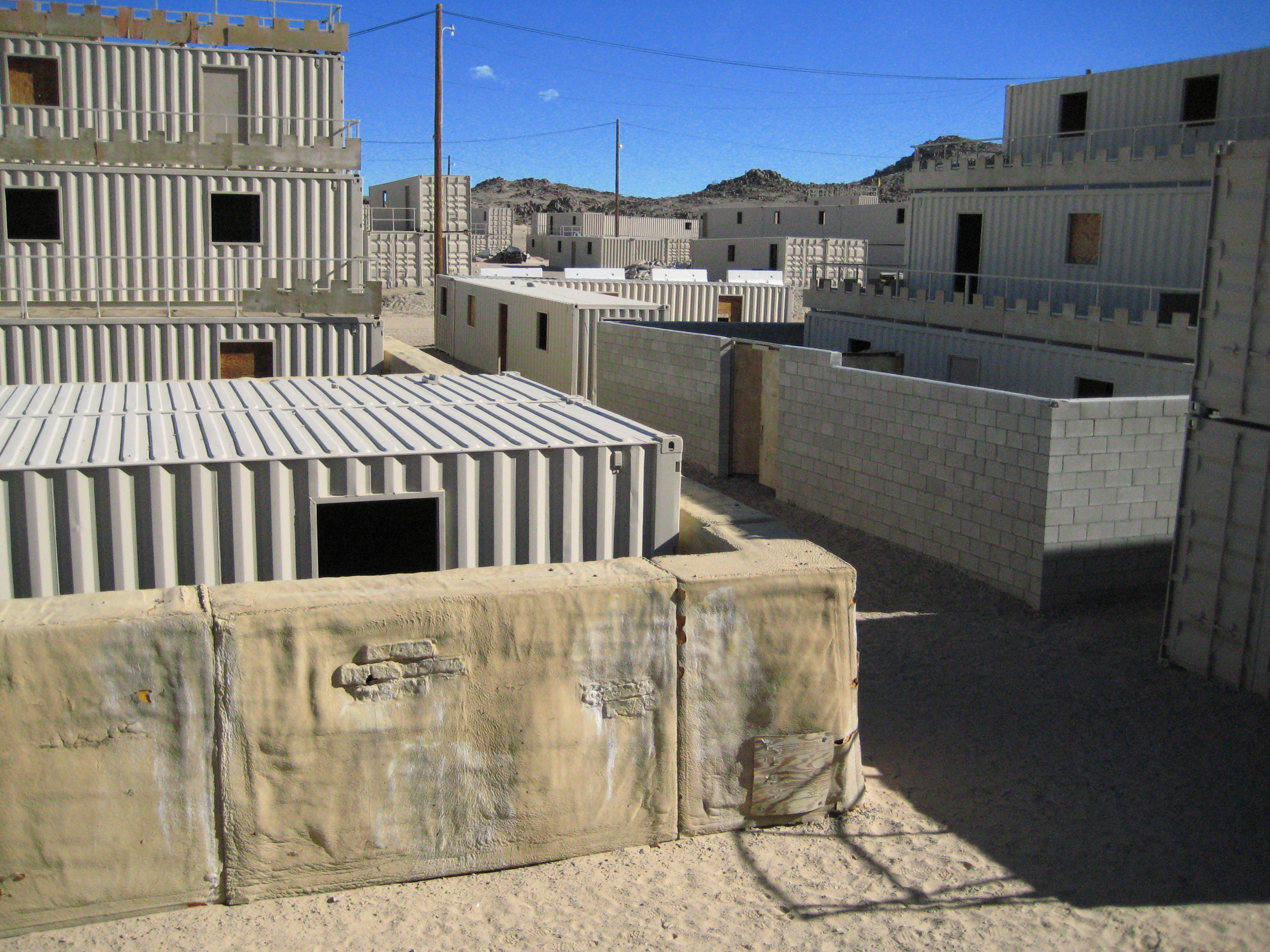
Read MoreDrawing the Twentynine Palms Marine Corps Air Ground Combat Center
Incendiary Traces led a recent draw-in at the 29 Palms Marine Corps Air Ground Combat Center where participants used drawing as a tool for connecting the SoCal landscape to foreign battle zones.
Read MoreThe Simulators
29 Palms Marine Corps Air Ground Combat Center | Photo courtesy of Incendiary Traces
After participating in the Incendiary Traces visit to the 29 Palms Marine Base, writer David Buuck contributes an excerpt from a novel about role players in a military training scenario.
Read MoreHarem Girls and Camel Races: Middle Eastern Fantasies in the Deserts of Southern California

Riverside County Fair and National Date Festival Pamphlet, 1952 | Courtesy of the California History Room, California State Library, Sacramento, California
The towns in the eastern side of the Coachella Valley have long utilized romanticized portrayals of the Middle East to shape views of their own desert backyard.
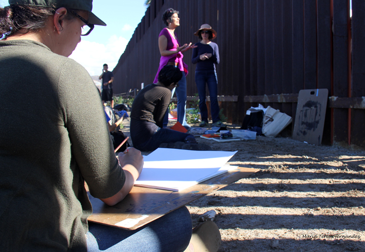
Read MoreReport: Tracing the US/Mexico Border Wall

Drawing by Hillary Mushkin
Artists, art historians, and students gathered to draw the most southwestern edge of the U.S./Mexico border as part of a continued investigation by Incendiary Traces.
Read MoreBattlefields of Santa Barbara

Detail map of Ellwood and Ellwood Offshore Oil Field, showing location of Luton-Bell Well No. 17, damaged by Japanese shelling Feb 23, 1942
How does modern war mark the California landscape? A single day's photographic record produced on the Southern California coast offers one compelling answer.
Read More